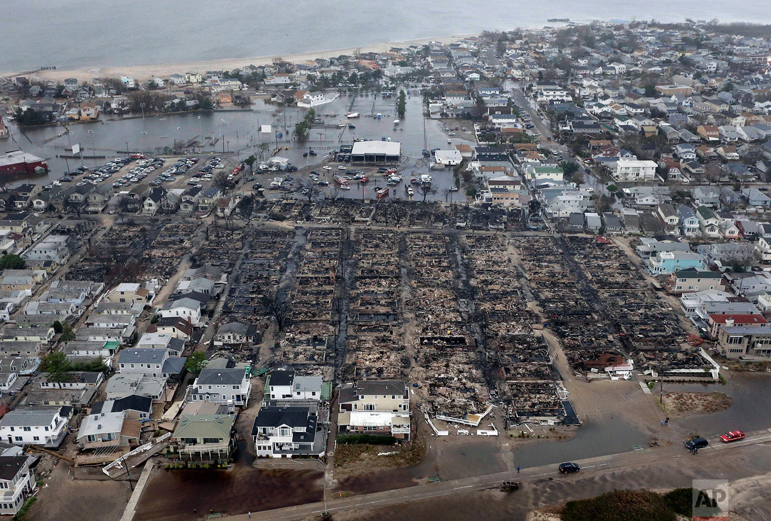
For years, New York’s political class has treated the threat of a “Superstorm Sandy 2.0” as a looming hypothetical. On Wednesday, a massive new study backed by artificial intelligence effectively turned that hypothetical into a mathematical certainty, identifying New York City as the most vulnerable coastal population center in the United States.
The study, published in the journal Science Advances, warns that a staggering 4.75 million New Yorkers—more than half the city’s population—live in areas classified as “high” or “very high” risk for flooding. Unlike previous models that focused strictly on storm surges, researchers at the University of Alabama utilized three distinct AI tools to analyze 16 variables, including sinking land, aging infrastructure, and the city’s vast swaths of impermeable pavement.
“Just look at the magnitude,” said study co-author Wanyun Shao, a climate scientist at the University of Alabama. “Those numbers are shocking, are alarming.”
While other cities like New Orleans face an existential threat by percentage—with 99 percent of its population at risk—New York stands alone in terms of sheer human exposure. The study estimates that more than 200,000 buildings across the five boroughs are likely to be damaged in future inundations.
“New York is known to be susceptible to floods and it has the largest population,” said Alex de Sherbinin, a geographer at Columbia University’s Center for Integrated Earth System Information, who was not part of the research. “But the fact that New York has nearly an order of magnitude more flood-exposed population than any other city is surprising.”
The data suggests that the city’s geography creates a “perfect storm” of vulnerability that outstrips other major hubs like Houston (600,000 at risk) and Jacksonville (679,000 at risk).
The report is landing with a thud in the halls of power from City Hall to Albany, specifically because it highlights a “social vulnerability” index. The researchers found that the elderly, the poor, and the undereducated are disproportionately positioned in the highest-risk zones.
“When the next big storm hits New York City… people will get hurt, especially those socially vulnerable populations,” Shao warned.
For local planners, the AI-driven data provides a grim roadmap of where flash floods are most likely to overwhelm current drainage systems. The study’s lead author, Hemal Dey, is urging a shift in policy away from traditional “gray infrastructure” like dams and levees toward “natural infrastructure” such as rain gardens and expanded wetlands.
The findings are expected to fuel ongoing debates over the “Big U” and other coastal resiliency projects that have faced delays and cost overruns since 2012. It also presents a thorny issue for the real estate lobby, a powerhouse in New York politics.
“The research is solid confirmation of what emergency managers have been saying for years. Realtors will hate it,” said former FEMA Director Craig Fugate. “The harder question is what we’re actually going to do about it.”
(YWN World Headquarters – NYC)