Lake Powell, one of the American West’s largest reservoirs that helps provide water, irrigation and power for over 40 million Americans across seven states is drying up.
Bordering Utah and Arizona, the man-made lake’s summer water levels are at their lowest in recorded history, according to Utah data.
That’s because of the historic, climate change-fueled spring drought which resulted in record-low snowpack to the region. Snowmelt typically helps to refill the 254-square-mile lake.
“It’s been a long time since it’s been this bad,” Russ Schumacher, Colorado’s state climatologist and the director of the Colorado Climate Center, told CBS News in March.
Experts say that the consequences could be dire, including additional cuts to water supply, summer tourism hits and, though more unlikely per USA Today, potentially even dropping to a level so low that flowing water would stop.
“These compounding factors are creating elevated risks to essential water and power infrastructure that supply water to more than 40 million people, underscoring the need for immediate action,” the Utah Bureau of Reclamation, which tracks Powell’s water levels, said in April.
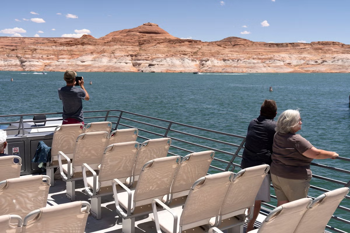
Lake Powell is an important tourist destination, and nearly five million visitors flock to the surrounding Glen Canyon National Recreation Area each year, National Park Service data shows.
Those visitors spent $518.2 million in communities near the park units in 2024.
But beyond the reservoir’s recreational purposes, supported by higher water levels, it’s also a critical source of hydropower.
The lake’s 710-foot-tall Glen Canyon Dam, the second tallest concrete-arch behind the 726-foot Hoover Dam, helps release water to produce five billion kilowatt-hours of hydroelectric power each year, according to the bureau.
That power is distributed to the state, as well as Wyoming, Colorado, New Mexico, Arizona, Nevada and Nebraska.
“In addition, revenues from production of hydropower help fund many important environmental programs associated with Glen and Grand canyons,” the bureau says.
The completion of the dam in 1963 is what created the lake, holding back the raging waters of the Colorado River. It took nearly two decades to fill the lake to the high water mark, or 3,700 feet above sea level.
The reservoir is currently at an elevation of just over 3,500 feet and is projected to continue to drop below levels needed for power by 2027.
“This outcome is not a reflection of recent drought response actions, but rather a clear reminder that the Colorado River remains vulnerable,” the federal bureau wrote on June 15.
The Colorado River has been in a state of drought since 2000, according to the U.S. Geological Survey.
The river system irrigates over 5 million acres of farmland and states typically get 7.5 million acre-feet of water from the river under a 1922 agreement, the National Agricultural Law Center explains.
Much has changed since then; far less water is available while demand continues to rise.
Long-term drought has reduced Colorado River system storage to about 36 percent of capacity, the bureau says, and the river is estimated to decline another 20 percent by 2050, researchers estimate.
The river’s flow is around 12.5 million acre-feet, but modifications to the agreement made in the last few decades total millions more, Penn State University says.
The agreement’s guidelines are set to expire by the end of year.
With the potential for water levels to drop further and an October deadline to strike a new deal between the states, the pressure is on.
“Maybe this is the first worldwide climate-change crisis that’s going to force really fundamental policy-level decisions to be made,” Brad Udall, of Colorado State University’s Colorado Water Center, recently told The Week.
Arizona, California and Nevada announced a plan to save up to 1 million acre-feet of water from the river through 2028, on top of other cuts.
Although negotiating officials have already missed key deadlines this decade, according to Inside Climate News.